Chris Ranck found this article discussing some new technology meant to improve firefighter safety:
… the Department of Homeland Security’s Science and Technology division has three projects underway that should reduce risk and improve the safety of U.S. firefighters.
When firefighters enter a building or a wildfire they “vanish off the map” in the words of DHS S&T — meaning a GPS satellite signal cannot follow them. Most firefighters also still use analog radio signals, which have problems getting through concrete, tunnels, forest and smoke-filled structures.
Yet nearly 90 percent of fire-related firefighter injuries happen within these types of structures, where locating an injured firefighter is a real challenge.
GLANSER is the Geospatial Location Accountability and Navigation System
for Emergency Responders, a tool that lets incident commanders locate and track first responders inside enclosed areas.
This portable tracking device comprises a microwave radio, battery and navigation technology. The commander can plug a USB powered base station into a laptop that transmits and receives signals; the more firetrucks with base stations the better the accuracy.
The GLANSER system can track approximately 500 firefighters simultaneously in a 50 story building and is accurate to as little as three feet.
The Star Trek-style PHASER
Rather than a weapon, PHASER is like a tricorder for firefighters.
PHASER is the Physiological Health Assessment System for Emergency Responders program that DHS S&T has been working on with UCLA. It monitors the pulse, body temperature and blood pressure of a firefighter and then relays his or her vitals back to the base.
According to U.S. Fire Administration
statistics, an estimated 81,000 firefighter injuries occur annually in the United States.
U.S. first responders have the highest occupational rate of line-of-duty deaths from cardiovascular and cerebrovascular incidents, making the ability to monitor and assist them an imperative.
Enabled by breakthroughs in medical science and technology, PHASER can instantly signal that a firefighter is in trouble and therefore expedite assistance from fellow firefighters.
While PHASER will let the commander know a firefighter is in trouble, fellow firefighters will still need to locate him or her. GLANSER and WISPER are two new technologies that can guide them to his exact location swiftly bring medical assistance.
PHASER uses a 900-MHz frequency, and due to its portable size, it needs a boost or it could be stopped by a wall or wall of trees in a wildfire. So it works with WISPER to achieve that boost and get the signal to the commander in spite of obstructions.
The Wireless Intelligent Sensor Platform for Emergency Responder (WISPER) relays a firefighter’s vital signs back to the firetruck so that the base can monitored them and track him through a fire.
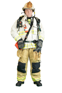
To use the system, a firefighter would carry a waterproof and heatproof canister (the coffee-mug sized containter is protected up to 500 degree Fahrenheit) on his belt with five of these throwaway signal routers — little discs wrapped in heat-resistant silicon.
When he enters an environment where his signal becomes disrupted, the base station signals his motor-powered canister to release a router or “crumb” as DHS S&T describes — just like in the Hansel and Gretel fable.
The routers arrange themselves like a network and pass the signal from node to node back to the laptop. Each WISPER has an antenna, a two-way digital radio and a 3-volt lithium cell.
Back at the base station, the WISPERs signal strength is monitored and if it falters the signal will be re-directed or the canister instructed to drop a WISPER.
The entire article can be found HERE.



#1 by Drew Smith on August 20, 2012 - 5:01 PM
I attended a focus group at the MABAS Readiness Center last year where Honeywell demonstrated the GLANSER (They hadn’t yet given it this name). It was slightly larger but worked pretty well. I used technology to track forward and backwards motion as well as turns and stair climbing. It then graphed this in 3-D. Their vision was that you could then import or layer that image onto CAD drawings and get a pretty good location of where people were at in the building. I think they have a way to go but are on to something.